Camas-Washougal logo tag

Drastic change of scenery at Coyote Wall

Recreation area in Columbia River Gorge was transformed by Burdoin Fire, which started July 18

By
timestamp icon
category icon Environment, Life, Outdoors

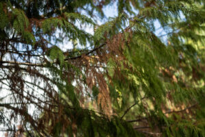
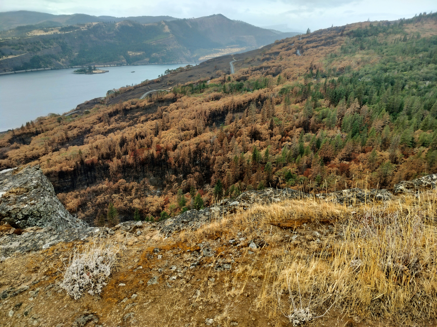
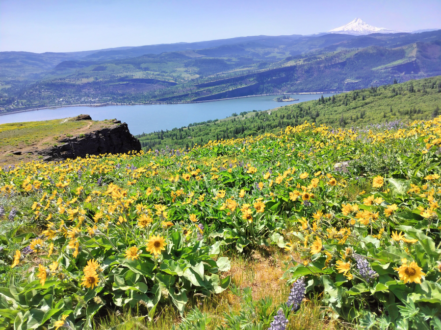
BINGEN — In spring, you can count on the Columbia River Gorge’s Coyote Wall trail network to dazzle the eyes with crowded carpets of yellow and purple wildflowers. In the heat of summer, Coyote Wall’s jagged, tilting grassland dries out into a furrowed plateau of glowing gold.

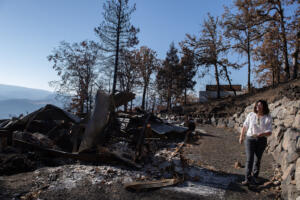
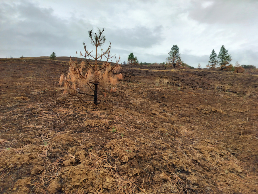
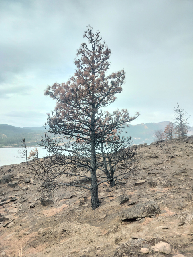
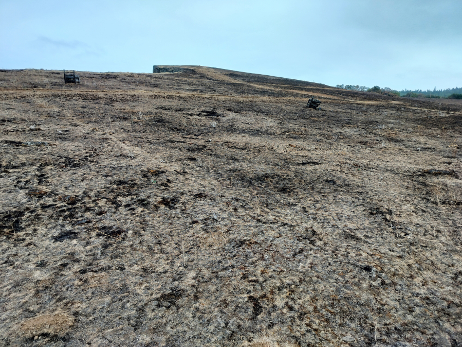
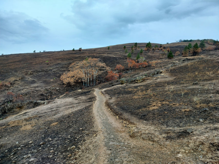
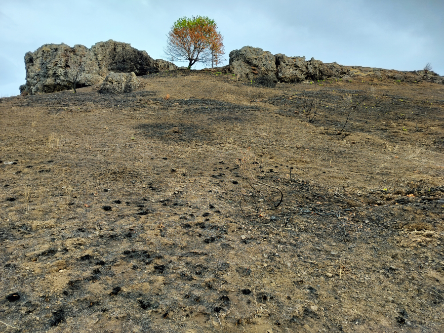
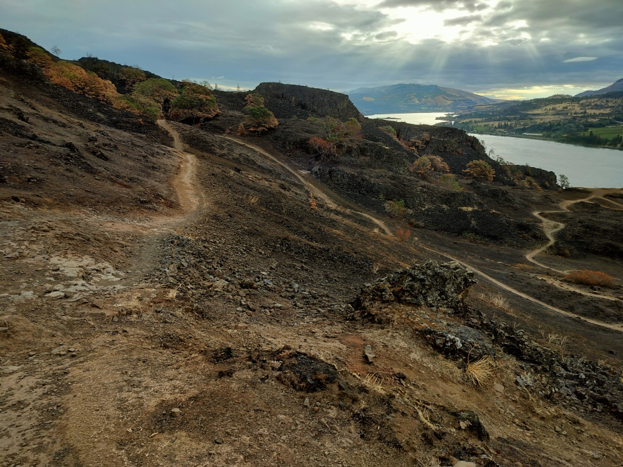
But when I went back in mid-September, what I found was a darkened, denuded landscape of exposed rock and mud. I caught faint whiffs of smoke. I’ve been here dozens of times over the past few years, but I barely recognized the place.

One of the most popular hiking sites in the Columbia River Gorge National Scenic Area, the Coyote Wall plateau was consumed by flames during this summer’s Burdoin Fire, which began July 18 and eventually swept across 11,000 acres of the northeastern Gorge. It’s not clear what caused the blaze, but dozens of structures were destroyed, and the entire towns of Bingen and Lyle were evacuated before the fire was fully contained in early August.

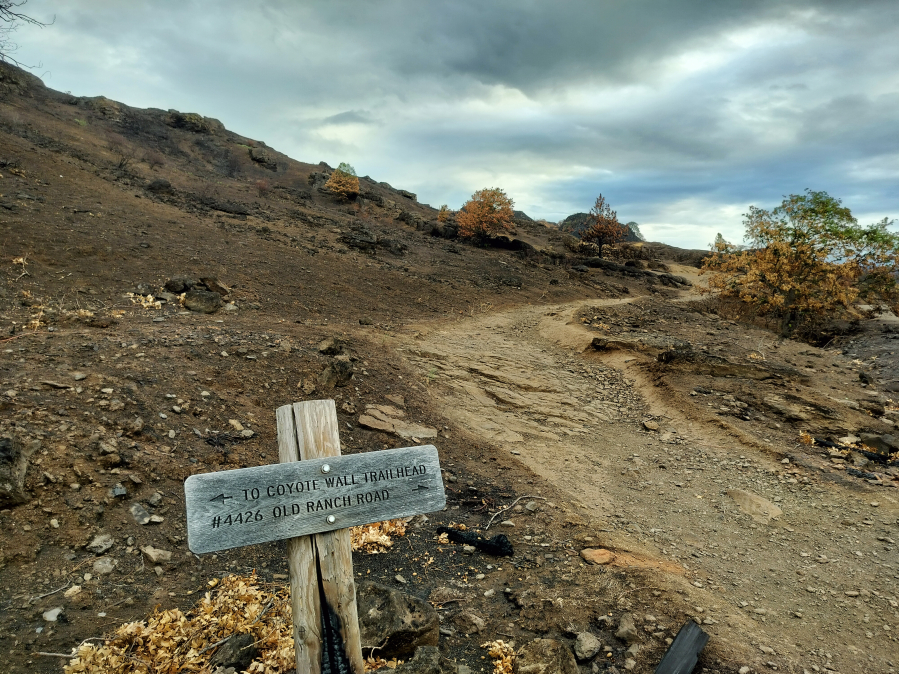
Public lands in the northeastern zone of the Gorge, from Bingen through Lyle, were closed to visitors during the fire and expected to stay that way through November. But almost everything has reopened ahead of schedule, and the only recreation area that’s still off limits to visitors is the adjacent Catherine Creek area, Coyote Wall’s scenic neighbor to the east, and that will be reopening within a few weeks, according to U.S. Forest Service spokesperson Beth Kennedy.

Coyote Wall has been a favorite destination of mine for years — a spiderweb of steep, sunny trails, oak-and-pine oases and huge views where it’s fun to get a little lost and found again. I went back early one Sunday morning in September with trepidation. (Coyote Wall is about 80 minutes east of Vancouver on state Highway 14, beyond Bingen. There’s no fee to visit. There’s one pit toilet.)

The big reveal came slowly. First, I noticed that the gentle slope between the parking area and the dramatic basalt cliff that gives the place its name had turned from thick shrubbery to naked dirt.

But the real shock came as I approached the spot where the main Coyote Wall foot trail branches off from an abandoned road and zigzags uphill through what’s usually a lush, colorful landscape of waving grasses, seasonal flowers and fascinating geological formations.

All the pretty decoration is gone now. Every crevice, crack and rocky outcropping, formerly hidden or softened by waving grasses or oases of trees, is exposed and charred. When I was there, the designated hiking trails — which hadn’t burned and weren’t charred — looked strangely lit up as they traversed blackened ground.

Weirdly, as I walked, I kept feeling like I was staring at a longtime friend I thought I knew well but had never seen naked before. It sure was interesting and revealing.

But on the whole, I’d rather not.

Robust regrowth

Fortunately, Kennedy said, Coyote Wall’s clothing is expected to come right back on.

“Immediately following wildfire, there is typically a robust growth of vegetation due to the influx of available nutrients from the fire,” she wrote in an email. “Forest Service lands experienced ecological benefits from the fire, with very little high-severity fire impacts to the landscape.”

The Burdoin Fire had little effect on the Coyote Wall trail system itself, Kennedy said, and that also goes for a native-plant revegetation project on the upper slopes near the wall. But emergency vehicles (including bulldozers) and firefighting activities did churn earth in spots. Those areas will all be repaired. The revegetation project will get new netting to prevent erosion and retain native plants.

“Seeding with native plant seeds will occur along all repaired/disturbed areas by spring 2026,” Kennedy wrote.

Native reseeding also will occur in places where the fire became really severe — which was less than 5 percent of the total burn area, she said. Any roadsides that cross Forest Service lands will be reseeded, too.

Why a wall?

What is Coyote Wall, anyway? The wall itself, which forms the west side of the big plateau, is an a unusually dramatic formation of basalt (volcanic lava rock) deposited here millions of years ago, then uplifted up by underlying seismic forces, shaped by the gargantuan Missoula Floods that carved much of the Gorge and finally revealed in its current form by landslides that came (and still sometimes come) in the flood’s wake.

Get the latest headlines in your email every week!

This field is for validation purposes and should be left unchanged.

The Coyote Wall we see today is only thousands of years old. In geologic time, that’s an infant!

I look forward to visiting the growing, thriving, appropriately clothed baby next year.